
Pemba, the green island
North of Unguja lies a hillier, greener and much quieter island. Pemba grows most of the archipelago's cloves, keeps a patch of old forest and asks for patience to reach.
- From Stone Town
- A ferry ride or short flight
- Pace
- Overnight
- Getting there
- Ferry or small plane from Unguja
- Bring
- Cash, modest clothes, rain jacket, insect repellent
Pemba lies north of Unguja, across a deep stretch of sea known as the Pemba Channel. On a map it looks like a smaller twin. On the ground it feels very different: hills folded into small valleys, thick green vegetation, clove trees on the slopes and far fewer visitors. Arabic traders are said to have called it the green island, and the name still fits.
Pemba is part of Zanzibar and so part of Tanzania, with Swahili spoken everywhere. Life here follows farming and fishing rather than tourism, and that is much of its appeal. It takes a little more effort to visit, but it rewards travellers who like quiet roads, village life and the feeling that they are guests rather than customers.
Ferry or flight to Pemba
There are two main ways to reach Pemba from Unguja: by sea or by air.
- By ferry. Passenger ferries run between Stone Town and Mkoani, the main port in the south of Pemba. Some services also link the islands with Dar es Salaam on the mainland. The crossing takes several hours and can be rough in windy weather.
- By small plane. Short flights connect Unguja with Pemba's airport near Chake Chake, the island's main town. Flights on small aircraft are quick but have strict baggage limits.
Schedules on both routes change often, sometimes at short notice. Keep your plans flexible, and allow a buffer day before any international flight home. Carry your passport for the journey, since checks are common.
The clove island
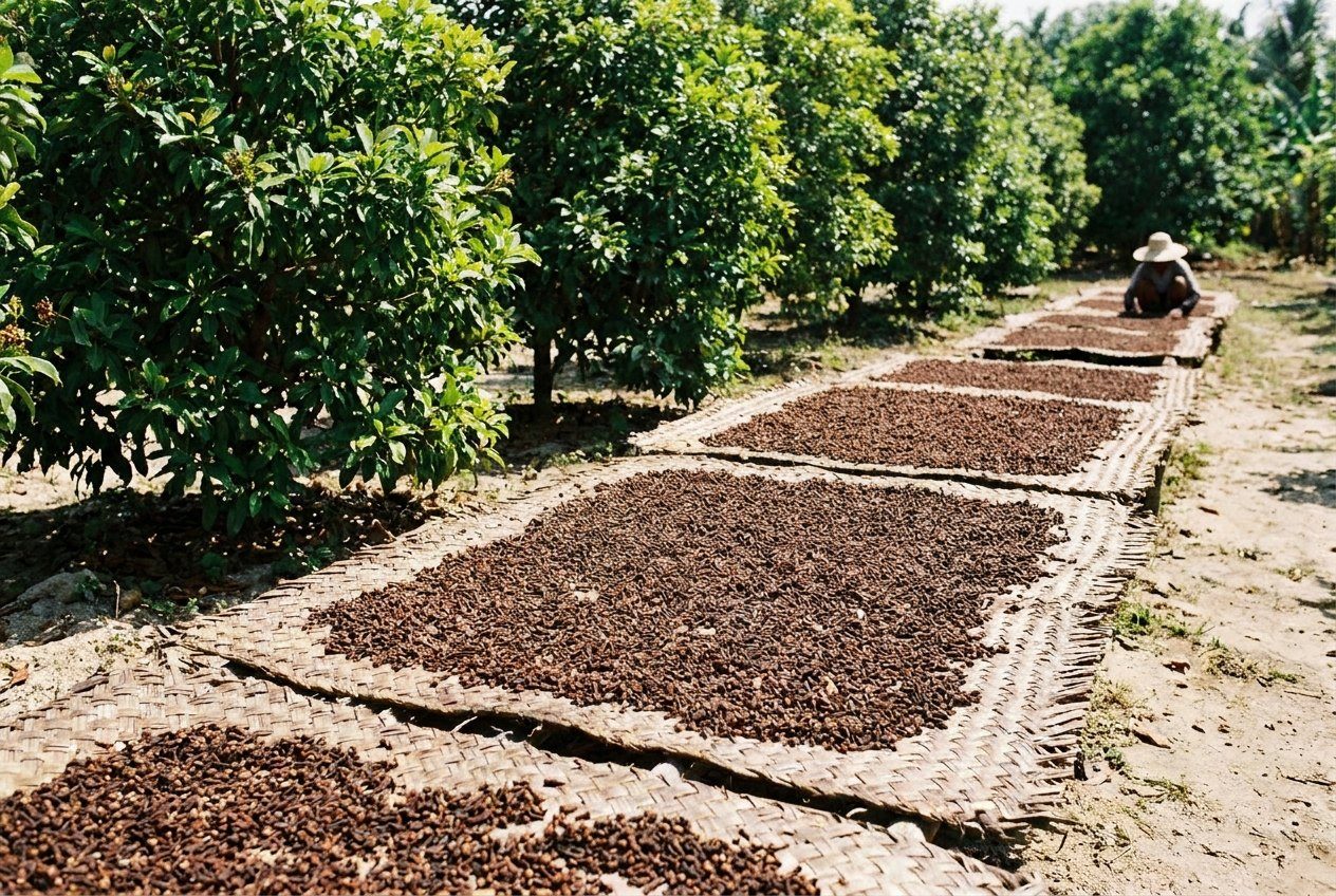
If Unguja is known for spices, Pemba is where most of the archipelago's cloves actually grow. Its deeper soils and wetter climate suit the trees, and in many villages almost every family has a few. During the harvest, buds are picked by hand and laid out on mats along roadsides and in yards to dry in the sun, turning slowly from pink-green to brown. The scent can fill a whole village.
The clove crop has shaped Pemba's economy for generations, with all the ups and downs that come from depending on a single export. Harvest timing varies with the rains, and in some years it is very different from others. If you want to see the work, ask locally about the season rather than relying on fixed dates. For more on how cloves grow and how they arrived here, read the story on clove, nutmeg and cinnamon.
Ngezi forest
In the far north of the island lies Ngezi Forest Reserve, one of the last patches of the tall, moist forest that once covered much of Pemba. Trails lead through dense trees, with ferns and creepers in the shade and patches of heath and swamp in places.
Pair it with Dhows and the monsoon winds
Ngezi is a good place to look for Pemba's own wildlife. The Pemba flying fox, a large fruit bat found only on this island, roosts in trees in parts of Pemba and has become a symbol of local conservation. The island is also home to birds found here and almost nowhere else, such as the Pemba scops owl and the Pemba green pigeon. The Pemba sunbird, which also lives on parts of the mainland coast, is easier to spot in gardens and scrub.
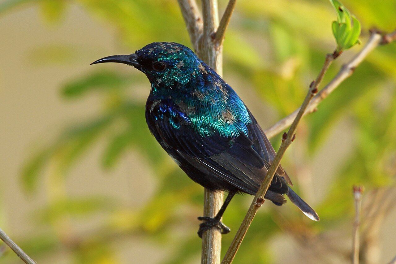 Picture: Nigel Voaden from UK · Creative Commons BY-SA 2.0 (source file)

Visits to Ngezi usually go with a reserve guide. Morning and late afternoon are the best times for birds, and evening visits may give a chance of seeing bats and owls. Bring insect repellent and good shoes, as paths can be muddy.
Diving and the sea
Pemba has a reputation among divers for steep reef walls and strong currents along the channel, as well as reefs around small islands offshore. The deep water close to shore brings in larger fish and clear conditions on good days. This is generally diving for experienced people, with drift dives and currents that need care and good planning.
For snorkellers, calmer reefs exist around some of the small islands off the west coast, where conservation areas aim to protect coral and fish. Conditions vary a great deal with tide and season. Follow the same reef manners you would anywhere: no touching, no standing on coral, no collecting.
Towns and villages
Chake Chake, the main town, has a market, small shops and an old fort-like building in the centre. Wete in the north is a port with a slow, open feel, and Mkoani in the south is where most ferries arrive. Between them, roads wind through farms, villages and patches of forest.
Pemba is conservative, even by Zanzibar standards. Dress modestly everywhere away from beaches used by visitors: long trousers or skirts, shoulders covered. Ask before photographing people. During Ramadan, eat and drink discreetly in public during the day. Learning a few greetings in Swahili, and returning a karibu with asante, goes a long way.
Cash, power cuts and the long rains
Facilities are simpler than on Unguja. Card payments and cash machines are less common, so carry enough cash, and expect limited choice in some areas. Power cuts can happen. Rain falls more heavily here than on Unguja, especially in the long rains of roughly March to May, when some roads become difficult. The drier months from around June to October are the easiest time to travel.
Take your time. Pemba rewards a slow pace: a morning in a clove village, an afternoon walk in the forest, an evening watching boats come in at Wete. It is the part of Zanzibar where the islands still feel as though they belong mostly to the people who live there.
If you are travelling north from Stone Town, the old sailing routes are part of the story too. The dhows and the monsoon winds once linked these islands with Arabia and India, and the sea crossing to Pemba still follows paths that boats have used for centuries.
With photos by Diego Delso · Creative Commons BY-SA 4.0 (source file); mwanasimba from La Réunion · Creative Commons BY-SA 2.0 (source file)

